Another Spring Lane Planning Application
 Another Spring Lane Planning Application
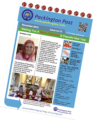
As mentioned in November’s Issue 75 of the Packington Post, just published, Outline Planning Permission has also been requested for 3 houses North of Spring Lane.
To see the Planning Application, click here: NW Leics District Council : Reference 15/01064/OUT | Proposed Residential Developmetn | Land at Spring Lane, Packington Continue reading ‘Another Spring Lane Planning Application’ »
Spring Lane Planning Application
 Spring Lane Planning Application
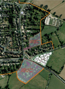
As mentioned in November’s Issue 75 of the Packington Post, just published, Outline Planning Permission has been requested for 8 houses East of Spring Lane, in land shown here as a white-ish triangle at lower-right of the map.
Also shown is the orange line marking the building development boundary of the village, as well as two other current fill-in development applications in grey.
To see the Planning Application, click here: NW Leics District Council : Reference 15/01051/OUT | Erection of eight dwellings | Land To The North East Of Normanton Road, Packington, LE65 1WS
Ashby & Food Gusto Fair Saturday 28th November 2015

Street party in Ashby! Read on for the Programme:
 |
Santa and his NEW SLEIGH
Santa has a new sleigh! To celebrate, he is bringing FREE presents for the first 150 children!
– come early to avoid disappointment.
We are grateful for the assistance of Rotary for looking after Santa on the day!
|
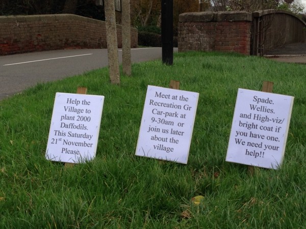
Daffodil Bulb Planting – Please Help! Saturday 9:30am
Wanted: DAFFODIL BULB PLANTERS
WE NEED HELP! We provid e the 2,000 bulbs, they just need planting!
Help beautify YOUR village for next Spring: come along this SATURDAY 21st November 2015
Meet at 9:30am at the Packington Recreation Ground Car Park
Please bring a Spade, Wellies or Boots, and a Hi-Viz Jacket if you have one
HOPE TO SEE YOU
Chris Miles 01530 414378
WI Coffee Morning
Saturday 28th November 2015 at Packington Memorial Hall. 10 – 12
Coffee, Cakes, Raffle, Books.
Everyone welcome
Packington Cricket Club Promoted !
This year Packington Cricket Club achieved promotion in the South Derbyshire league:
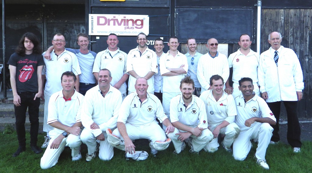
Join Us!
Packington Film Club – Friday 13th November
Inaugural Film: “The Second Best Exotic Marigold Hotel”

Doors open for Refreshments at 7pm
Film commences at 7:30 pm
certificate (PG) 122 mins
Tickets available at the door: Adult £3.50, Child (under 12) £2 Packington Film Club
FREE Adult Keep-Fit Class at Packington Primary School
Every Tuesday in term time, 11am – 12 noon

Local Plan – Have YOUR Say

The North West Leicestershire Local Plan will affect every member of our community in some way, and they’d like you to have your say.
 The plan will be a guide to where new homes, businesses and jobs, schools and open space will go, as well as how we will protect the local environment.
Planning officers and members of the Planning Committee will use this document and the policies in it when deciding whether to permit or refuse planning permissions.
This consultation is your chance to give your Continue reading ‘Local Plan – Have YOUR Say’ »
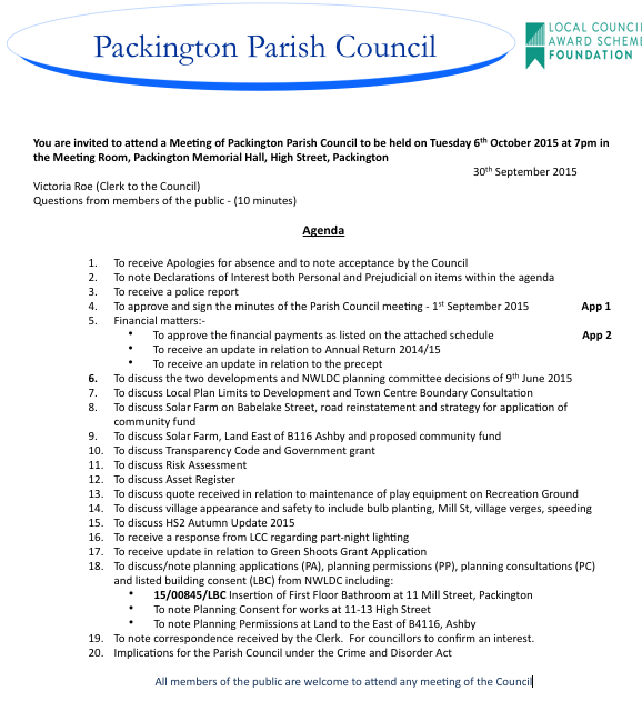
Whats ON! Agenda for Tuesday 6th October 2015 Parish Council Meet
2 New Housing Estates? Speeding in our village? HS2 Autumn Update? Police report? Where to spend the Babelake St Solar Farm Community Fund? – hear about it at Memorial Hall at 7pm Tuesday 6th October
Packington Youth Club Calendar Update to November 2015
Missed Monday 21st September? – come NEXT MONDAY, or any of these dates: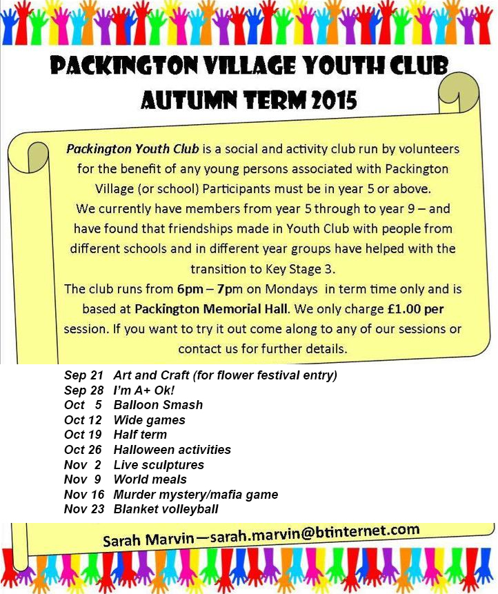
73rd Packington Horticultural Show 2015 – Winners List
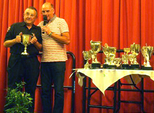
73rd Annual Packington Horticultural Show – Winners List
This year’s 73rd show was very well supported, in the tradition of the annual Packington Horticultural Society (PHS) Show. The large number of exhibits were all carefully considered by the 2015 panel of judges, who were: L Brookes, M Jones, C Bellfield, A McCarthy-Young.
Richard Meadows won the Banksian Medal, the RHS-granted award to the show winner gaining most points, and he is seen at left receiving the prestigious Frank Moore Banksian Trophy from PHS Committee Chair, Robert Parry.
You can read about the show in our printed magazine Packington Post Issue 74 page 4. As mentioned there, a full list of winners is below: Continue reading ‘73rd Packington Horticultural Show 2015 – Winners List’ »
Packington Post Issue 74 September 2015 – Now online!
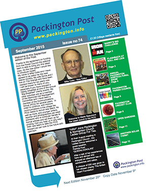
Packington Post Issue 74 was published on 16th September 2015 – it’s now available here online
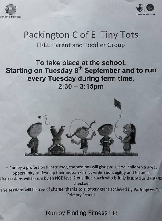
Tiny Tots – FREE Parent & Toddler Group at Packington School
Every Tuesday during term time, 2:30 – 3:15pm